Wednesday, August 31, 2022

Montana GHOSTS

Day 28—Monday, Aug 29—Grasshopper Campground to dispersed camping on Medicine Lodge Road 

60 miles 

The first part of the day was still on the paved byway, a chilly but welcome downhill on the southern face of the ridge. This allowed me to add some easy miles23 miles before lunch!  


Couldn’t figure out this contraption that dotted the landscape until I came upon the explainer about the "Beaverslide," invented in this county in 1908:


Oh, I see where I am going

Since I passed within a mile of Bannack State Park and the ghost town of Bannack, I spent about 90 minutes walking thru these old buildings. The town emerged from an 1862 gold strike and mushroomed to 3000 people in 1863 and was one of the largest towns in MT at that time. However, the 1864 territorial deducting made the town less important. The state finally took control of the entire town in the 1980s after the last two sisters living there moved on. Fascinating place. 


Masonic lodge


"How many bushels in a peck?"


Hotel Meade: exterior and interior entryway


Belly to the bar...reflection in wavy mirror (the jug is not mine)


From here I rode up on Bannack Bench, a raised meatloaf-type topographic configuration, and then descended to a town called Grants where I hoped to have a hot meal. Unfortunately, the restaurant didn’t open for several hours but the owner sold me a couple of cold cokes which I dispensed with while listening to loud talk radio bemoaning student loan forgiveness: enough, time to move on.


Bannack Bench


American Pastoral, Montana version


Medicine Lodge Road

Prior to this stop, I ran into T.J. Statt from Cincinnati who was trying to get to a dispersed campground 20 miles up a gravel road. So that was my aim.

Finally made it after an unfortunate flat tire four miles away from the campsite. Located in a creek valley, the sun was just disappearing behind the mountains, but I managed to get a sponge bath in the local creek which cooled me down.

T.J. retired at 47 and he and partner live in a van which is now parked in Denver as his partner prepares to fly to Spain to walk the Camino de Santiago. They have solved the puzzle! They hiked the Appalachian Trail last year and are hiking the Pacific Crest Trail next year. Hats off to them.

Things were cooling down quickly with a good breeze so we made something of a dinner and then I got to enjoy my version of "retiring early" by retiring to my tent.

TJ was the first biker I had seen in days so it was good to have some companionship!


Another nice last view of the night from the tent


Tuesday, August 30, 2022

STEEP Descent

Day 27—Sunday, Aug 28—Beaverdam Campground to Grasshopper Campground

49 miles 


Thanked the bull for the pic; when I asked what I owed him, he said “it’s Sunday, no charge ...”

Chilly morning start up to Fleecer Ridge which was quite a bike and push to get up to the flank of the ridge.  


Rocky road:  bumpy and slow going

From there the downhill was crazy nuts. The maps warn of the steepness of the descent and suggest zig-zagging through the sage brush to break one’s speed. I started down thinking I’d go slow. I just got break pads replaced in Helena but had concerns about going over the handlebars, it was that steep (by my guess it was a 1:1 slopefor every foot horizontal go up 1 foot…or a 45 degree angle). I'm not even sure how they made this trail—bulldozer?


Flank of Fleecer Ridge up to the upper left between the trees.


Starting the descent to Wise River


I have no idea how northbound people negotiate this stretch; you cannot push a fully loaded bike up this (having become something of an expert in pushing!)


Once I got down to a “reasonable grade” it was a fun descent through a creek valley into Wise River where I ate a frozen burrito defrosted on my handlebars.  500 calories each so good calorie/cost ratio.


Wise River:  one of the best fly fishing locales in MT


Calorie binge before the final climb

From Wise River the trail becomes a scenic byway (paved road) at a decent grade except when we had to climb up and out of the creek valley and the road became steep to a high meadow flanked by mountains. Finally worn out from climbing I was treated to a nice downhill and reached Grasshopper campground. On a Sunday night, I was the only one there. The volunteer host lets bikers stay for free!  Very hospitable. Set camp, made chili-Mac for supper and went to bed at the usual time…around sundown!


View from the byway


Peek at the peaks around the corner; not much shoulder to work with but drivers were courteous


Lovely pattern


High meadow: "Moose Meadow" but sadly saw none


Just beginning the descent into Grasshopper Valley (freaking bugs are everywhere)

Monday, August 29, 2022

Monday Meditation on GRAVEL


Rail trail way up in the mountains: travel path is mostly clear of gravel. Nice


So, someone asked about gravel roads compared to pavement.

In the early 1980s, William Least Heat-Moon published a book called Blue Highways. It was an odyssey that avoided the interstate and followed the highways marked as “blue” in his older analog maps: probably US routes, state highways, county roads that connected small town to small town, many of which were bypassed and devastated when the interstate was built. It’s a good read.

The Great Divide Mountain Bike Ride takes this a step further: the route never goes on the interstate and rarely goes on the state routes unless there is no corresponding road. So we’re talking a lot of gravel and dirt roads.

That could be enough to say until you experienced the variety of gravel and dirt.

There are some gravel roads that are packed hard so it is almost like riding on pavement and there are some with loose thick gravel that makes it feel as though you are riding a bike through slush or sand. There are some where fist-sized rocks have dislodged and/or embedded and where boulders need to be avoided. When descending on gravel roads, you may end up negotiating all types of gravel within a hundred yards: hard-packed to slushy to rocky.  At times it can feel like water skiing, sliding on black ice, or rolling over a trillion loose marbles. It’s crazy.

Ascending on gravel roads provides the same challenges except without the benefit of momentum. Depending on the speed one can muster on an ascent, gravel mobilizes to slow your roll in a number of ways: 1) every rock bigger than 3/4” is an obstacle and will slow you down, if not stop you: larger stones are even more effective; 2) everything is moving: when your front tire hits the gravel the tire can slide sideways because the gravel is not fixed; when you are hoping for traction from the rear tire which propels you, the tires can spin off the rocks, giving you a feeling of two feet forward, one foot back; 3) depending on the depth of the gravel, it can feel like snowplowing.

Another unique effect that is common is washboarding, that insufferable condition where repeated passes by cars creates a regular series of mounds or ripples that, going downhill, can loosen the fillings in your teeth, catapult secure items from your bike, and create havoc in terms of keeping the bike upright. Uphill it’s just as annoying and can feel similar to a canoe trying to cross the wake of a motorboat at a right angle (whop, whop, whop) until the road levels out.

The amount of gravel used is ostensibly the best way to maintain these roads and in most cases their condition is impressive. Most importantly, these are the “roads least traveled” and it does make all the difference: fewer cars, the ability to use the whole road when trying to find the literal path of least resistance, and a powerful connection to the curvature of the each mountain’s topography that one just won’t experience on a paved highway.

When we do connect on a paved road, it feels like silk: no resistance, easy to pedaluntil that first semi passes by five feet away to break the reverie.

The Great Divide Mountain Bike Ride is mostly gravel roads and it works. Not the fastest way to travel, but the benefits certainly outweigh the shortcomings, as frustrating as they can be at times.


Washboarding;  a hazard descending and an annoyance ascending


Wide gravel road after a rain can get a little squishy


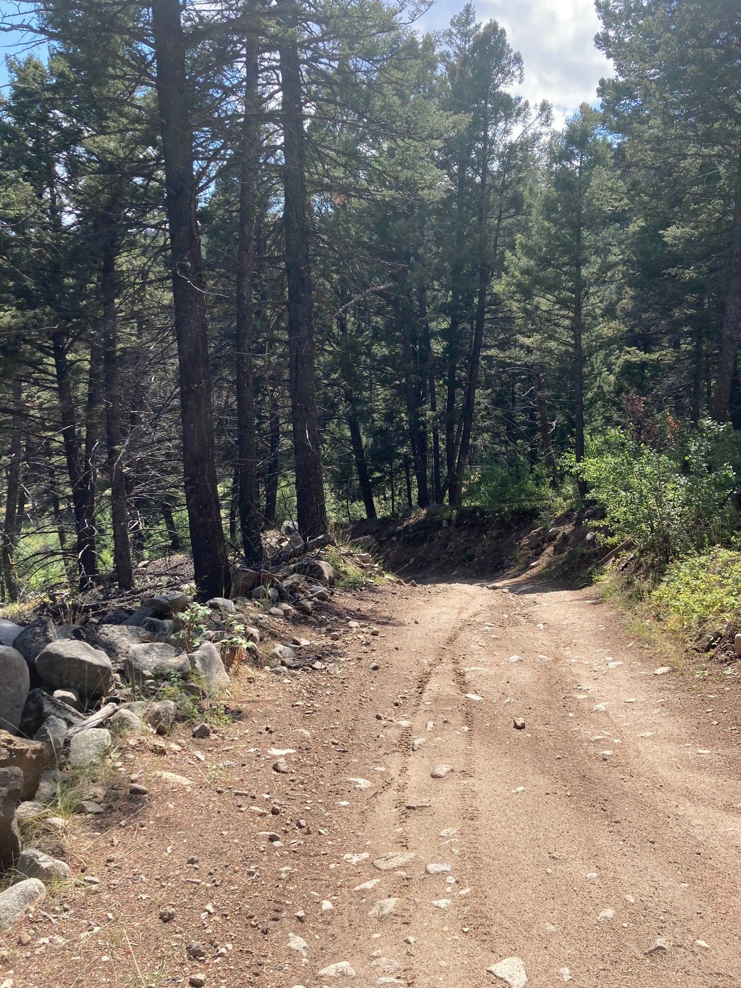
This is more of a dirt road but note embedded rocks


Road with various gravel sizes:  like biking on marbles


Sandy gravel: after rain, mushy.  Slushy gravel: descending, hazard; ascending, roll stopper


Rocky gravel: Take care coming down; roll stopper if ascending. 


Avoid the big rocks going up and down


Sunday, August 28, 2022

STUNNING Downhill

Day 26—Saturday, Aug 27—south of Butte, MT to Beaverdam Campground

25 miles; cool breeze, warm sun


Climbing way up above and beyond Butte in the far distance

Day began with a long climb (of course!). I was nearly out of water but found an abundant source in a mountain stream (which I filtered). With my bike laying down along this gravel road, a couple of folks came by dragging four wheel drive carts and stopped to ask if everything was OK. After assuring them I was just collecting water I continued up to the summit where they were conducting a training on search and rescue. I spoke with Frank Finnegan who was one of the trainers and we chatted about mining, and search and rescue. The target of the rescue training today was a fictitious mountain biker—and that’s why I got all the questions.


Fresh water in the nick of time!


Search and rescue training; had my chance to play a wounded mountain biker. Oh well


The summit was lovely with the Pioneer Mountains ahead and the trail leading me through grassy highlands with cows on and about the road. The path was up and down until reaching another summit from which I sharply descended into a broad valley. It was perhaps the most stunning downhill I have ever experienced since I could see so much (even topping out at 25 mph and trying to keep the bike upright). That thrill was replaced with a four mile grind into a headwind to get across the valley floor before starting to climb again.


Pioneer Mountains beyond


Would love to know where these cows get their spray paint; can’t disagree with their perspective; life for them is proscribed and short.


Starting descent into valley


Straight down


Steeper than it looks

I came upon Beaverdam Campground, which Linda from Helena had recommended. Decided to have a hot lunch in lieu of the usual and to make this a shorter day of 25 hilly miles. Fleecer Ridge lies up yonder and I’ll tackle that climb when I am fresh tomorrow.

Gorgeous afternoon: cool breeze, warm sun; probably in the low 70s. The knee I injured last winter after a biking crash on black ice is twinging for the first time…another reason for keeping today's miles down. The schedule I blocked out back in the springknowing nothing about the terrain or my capabilitiesshows me about 3 days “behind” after almost 4 weeks of travel. We’ll see what that means down the road.

I didn't see any other bikers today or yesterdaynot sure if the herd is in front or behind but guessing the former. Plugging along.


Small world department: shared dinner with a young couple from Washington, Robert and Amanda Swindler (and Daisy!) moving to Missouri to start a co-housing community. Their mom knows my friend and colleague Kitty Ryan from Notre Dame days!